Showing posts with label san gabriel mountains. Show all posts
Showing posts with label san gabriel mountains. Show all posts
Sunday, June 30, 2013
Ice House Canyon Trail
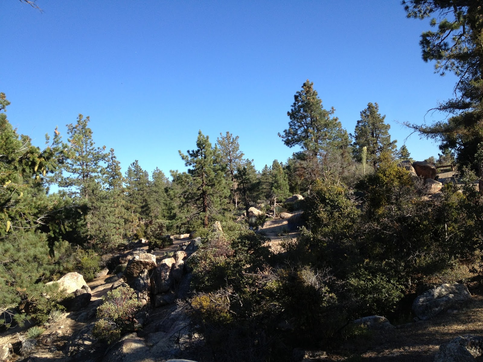
The other day, I took the Chapman Trail, which was entirely new to me. You have to walk up the Ice House Canyon Trail for approximately a mile, and then you will see it on the left hand side marked by a sign. I found it to be almost empty, in contrast to the dozens, if not hundreds of people on the Ice House Canyon Trail to the South. The Chapman Trail offers some beautiful scenery as you traverse moderate switchbacks through chaparral, oak, cedar groves, unspoiled meadows, towering yucca with giant white flowers across a background of blue sky. Eventually winding up at Ice House Saddle, I can hardly wait to go back here. In fact, I think I will tell them I am sick later this afternoon so I can get out of the office and back on that trail. Healthy rodent population, trees look green and healthy for the most part, plenty of birds but I didn't see any raptors at all. You are going to arrive at the wilderness boundary at the 3 mile mark, after which you will need a permit(Baldy Ranger Station). Get an adventure pass to park(Big5). This is a really sacred place, and whatever little words I put on the internet don't do it much justice.
Spring is an absolutely stellar time to come out to either of these trails. The scenery includes red, white, pink, blue and purple wildflowers, a billion shades of green, endless blue skies, all backed up with a chorus of that babbling brook off to the side of the trail. There is some damage here caused by the bark beetle, but it is not too extensive. When I arrived yesterday, the parking lot was full, but I had no problem getting a permit from the Ranger Station and made it to the top in a leisurely two hours. When you get to the top of the saddle, there are several other trails to continue on if you so desire. I posted some photos so you could see what I am talking about.
The trail goes uphill for about 4 miles, following a creek for the first half of the hike. There are several areas where the freezing cold water is deep enough to take a swim and several places where you could just spend the whole day taking in the greenery and the scenery with a picnic basket. There is a lot of shade, but you will still need some sunscreen.
You are going to see a ton of squirrels, birds, and chipmunks on this trail. There are also bear and deer so if you decide to camp here, get a bear can and don't bring chapstick or lotion into your tent. You are also going to see a ton of people, but nothing compared to the trails in Griffith Park or Runyon Canyon and the flash mobs that suddenly appear there at 7AM.
The Cucamonga Wilderness which you pass through about midway up the trail is stunning. These mountains are majestic and almost impassable. You are going to belvedere yourself when you see the views as you are climbing through this wilderness. You need a wilderness permit to hike past this boundary and can obtain it at the ranger station. Keep in mind they are not open every day. Call in advance.
As you get towards the saddle, the trail narrows a bit, and the chutes are probably a hundred feet down or so. Tell your children to be careful here.
Inspiration Point Via Castle Canyon
could not wait to come back here, so I picked the hottest day of the Summer so far, and let me tell you folks, this trail is a real ass kicker! If you are jogging, you are probably burning around 800 calories an hour so make sure to have eaten plenty of rice or steamed potatoes the night before you set out. Drink a shitload of water before, too! There was not much traffic on the trail at all. I saw a few nice folks on the Sam Merrill Trail on the way up, but there was not another human soul in Castle Canyon yesterday afternoon.
If you ever want to get connected with the spirit of Summer, then you could do a lot worse than this trail. It is hot and just keeps getting hotter. The rocks are like charcoal briquettes and just toasted me yesterday. There was no shade at all. The last time

Chilao Campground
I came here afterwork yesterday and occupied campsite #39 in Manzanita Loop. There were a total of three other parties in the entire campground and the experience could not have been anymore magnificent. My godson who is three had his very first camping experience was absolutely delighted with Chilao. He climbed around the boulders, explored the vicinity of our space, ate s'mores, hot dogs, sat around the fire, watched the stars, and collected pine cones and rocks. He could not have been any happier. We will both surely never forget this fantastic little trip. We saw blue jays, crows, squirrels, chipmunks, and a couple of red tailed hawks. The forest has come back since the Station Fire and looks much better than it did the last time I was here approximately two years ago when it looked like Downtown Grozny.
It was a fine night to go to Chilao. The temperature was in the 60's all night and the moon and stars were just breathtaking. Instead of the sleeping in the tent, I put my air mattress in the middle of a clearing so I could get a better look at the stars and planets. I turned on a little Frank Zappa and had some cold ice water and crashed. I woke up at 4AM and took a leisurely two hour stroll in the moonlight. The burned trees in the moonlight reminded me of skeletons and the purple flowers of the poodle dog brush glowed like they were under a blacklight. The forest looked hopeful and like a war zone simultaneously. An owl's call and some crickets were the only sounds in the canyon. I went to some intense boulders on one end of the canyon south of the park and climbed to the top of the stack and carefully observed what was going on around me. Life can be exceedingly disappointing when you look at the big picture, but very grand indeed because of times like this.
Campsite-$12
Food-$25


 Gas-$10
Firewood-Free
Memories-Priceless
Gas-$10
Firewood-Free
Memories-Priceless


 Gas-$10
Firewood-Free
Memories-Priceless
Gas-$10
Firewood-Free
Memories-Priceless
Mt. Baldy via Old Baldy Trail
There are several routes up Mt. San Antonio, but none as punishing as the Old Baldy Trail. The trailhead is located about 3/4 mile up a paved road behind the Ranger Station in Baldy Village. There are some National Forest Cabins to look at and the largest Lodgepole Pine in the world near the top of the road in some lucky individual's front yard. A creek runs through this canyon year round, and the road is shaded the entire way up. At the end of the road, the trailhead begins with some easy switchbacks through a shaded canyon with plenty of old oak trees and assorted wildflowers. You begin to see huge views after about a mile or so, and eventually you get to a campground situated among pines and yucca. The water source at this campground is the last one on the trail to the summit of San Antonio. Use a filter or risk intestinal infection.
Now is when the true hike begins! You will rapidly ascend a series of steeper switchbacks. The trail is no longer shaded, but fully exposed. Yucca, wildflowers, contorted pines, chaparral, and some very cool rock formations await you at every turn. Raven and blue jays abound. This ascent continues for a while and eventually you will be able to see Twin Peaks, and the summit. There is a more narrow area, and some great views. The way down is significantly shorter if you run carefully down the same trail. It is like running in heaven.
Mt. San Antonio is not a mountain to be fucked with lightly and the numerous annual fatalities documented in the local paper will attest to that. Take a jacket, a hat, sunglasses, sunscreen, food and as many of the other 10 essentials that you can get into your pack. This is a difficult hike by any standards and has a lot of elevation gain. The trail is clearly marked during three seasons. If you decide to come here in the Winter and tackle this trail, keep in mind that it is a dangerous alpine environment and you should proceed accordingly. 


Subscribe to:
Posts (Atom)